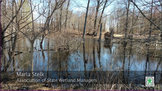
NAWM
The National Association of Wetland Managers is a nonprofit membership organization established in 1983 to promote and enhance protection and management of wetland resources, to promote application of sound science to wetland management efforts and to provide training and education for our members and the public. Membership is open to anyone who is involved with wetland resources.
Calendar of Events
This calendar provides a place to share upcoming U.S. wetlands and water resources events. Note that the National Association of Wetland Managers (NAWM) has set up this calendar for information sharing purposes only. NAWM does not endorse the listed events.
Event listing information:
- As a NAWM Member, there is no charge to have your membership's organization event listed.
- Non-members will be charged a $100.00 fee per listing for an event.
- If you are not a NAWM member and would like to join, please join here.
- Your event will be listed for 60 days.
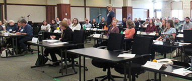
| MEETINGS | ||||||||||||||||||
| North American Congress for Conservation Biology - Conservation & Restoration for People & Nature Society for Conservation Biology NA and Society for Ecological Restoration |
July 12-16, 2026 |
Milwaukee, WI |
||||||||||||||||
| TRAININGS | ||||||||||||||||||
| Introduction to Wetland Identification Rutgers University Office of Continuing Professional Education |
June 15 -16, 2026 | Online |
||||||||||||||||
| Wetland Construction: Principles, Planning, and Design Rutgers University Office of Continuing Professional Education |
June 24, 25, 29, and 30, 2026 | Online |
||||||||||||||||
| Hydric Soils Rutgers University Office of Continuing Professional Education |
July 28 - 30, 2026 | Online | ||||||||||||||||
| Vegetation Identification for Wetland Delineation: South Rutgers University Office of Continuing Professional Education |
August 26 - 27, 2026 | Online | ||||||||||||||||
| Methodology for Delineating Wetlands Rutgers University Office of Continuing Professional Education |
September 24 - October 1, 2026 |
Online/Basking Ridge and Cranbury, NJ | ||||||||||||||||
| 2027 Wetland Science Conference Wisconsin Wetlands Association |
February 23 - 25, 2027 | Elkhart Lake, WI | ||||||||||||||||
| Dates/Location | | | Agenda | | | Meeting Materials | | | EPA CWA Resources/Trainings | | | More Information |
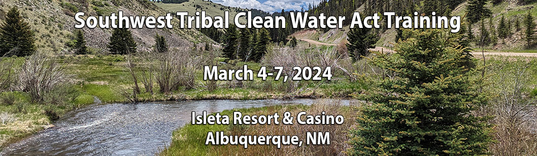
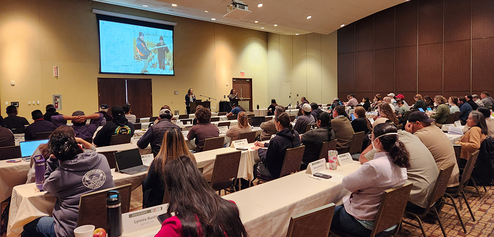
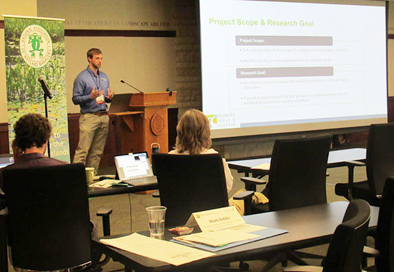
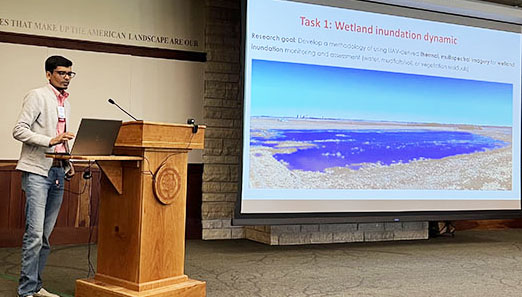
The Southwest Tribal Clean Water Act Training was held March 4-7, 2024 at the Isleta Resort & Casino in Albuquerque, NM. This training was organized by the National Association of Wetland Managers (NAWM) and Saint Mary’s University of Minnesota GeoSpatial Services (SMUMN GSS) in partnership with the U.S. Environmental Protection Agency (EPA). The training workshop was open to tribal staff involved in implementing water quality monitoring and assessment programs and related Clean Water Act (CWA) programs from across the country, with a focus on examples and applications for Tribes in the southwest. The training addressed four areas key to water programs: 1) Regulatory and non-regulatory approaches to program building; 2) Water quality standards; 3) Monitoring and assessment; and 4) Data (collection, management, etc.).
Training Workshop Dates and Location 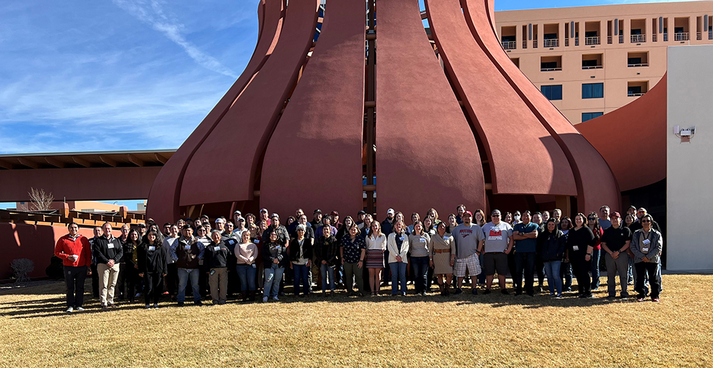
When: March 4-7, 2024
Location: Albuquerque, NM
Where:
Isleta Resort & Casino
11000 Broadway SE
Albuquerque, NM 87105
The training included three days of presentations, in-depth training sessions, and breakout discussions. Copies of training slideshows are provided below.
DAY 1: BIG PICTURE – CLEAN WATER ACT (CWA) PRIMER AND REGULATORY UPDATES
- Water Quality Program Basics (Liz Rogers, EPA Region 8)
- A Basic Introduction to Water Quality Standards (WQS) (James Ray, EPA)
- A Basic Introduction to Monitoring, Data, & Assessment (Adam Griggs, Jesse Boorman-Padgett, Cristina Mullin, and Rob Cook, EPA)
- Review of Current Federal Rulemakings and Proposed Regulatory Changes – Part 1 (James Ray, EPA)
- Review of Current Federal Rulemakings and Proposed Regulatory Changes – Part 2 (Lauren Kasparek and Myra Price, EPA)
- Sackett v. EPA: Potential Implications for Tribal Nations (Nadine Padilla, University of New Mexico School of Law)
 DAY 2: SHARING STORIES – LESSONS LEARNED FROM TRIBES
 - Overview of White Mountain Apache Tribe’s Water Resources Program (Sean Parker and Javis Davis, White Mountain Apache Tribe)
- Protecting Tribal Water Resources in Northwest California (Gregg Young, Potter Valley Tribe)
- 319 NPS Work Building BMP Structures to Address Impacts from the 2011 Las Conchas Fire and Flooding (Dino Chavarria, Santa Clara Pueblo)
- Taking Action on Stormwater Pollution: Snoqualmie Tribe Floating Treatment Wetland Installation (Kelsey Payne, Snoqualmie Indian Tribe)
- Water Quality Standards and Ongoing Work to Protect, Monitor, and Improve the Water Resources of the Pueblo of Santa Ana (Tammy Montoya, Joshua Jojola, and Malcolm Vigil, Pueblo of Santa Ana)
- You Inherited a Monitoring Program. What Now? (Megan Poffinbarger, Pechanga Band of Indians)
- Challenges in Monitoring Different Waterbodies on Santa Clara Pueblo (Robert Gutierrez and Jake Naranjo, Santa Clara Pueblo)
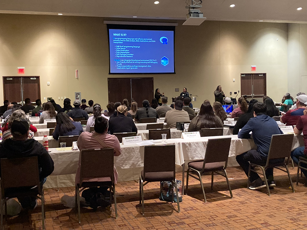
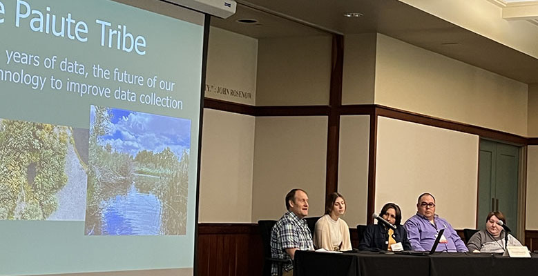
- Flowing Knowledge: Leveraging R Software for Management and Analysis of Water Quality Data on the Bishop Paiute Reservation (Brianda Hernandez and Sabrina Barlow, Bishop Paiute Tribe)
DAY 3: A DEEPER DIVE
- Regulatory & Non-Regulatory Approaches:
- Federal Grant Writing: Identifying Opportunities and Developing Proposals (Dana Catron, NMSU Arrowhead Center)
- CWA §319 Tribal Program: Nonpoint Source Pollution Management (Margot Buckelew, EPA)
- Wetland Program Development and GAP Grant Program (Myra Price, EPA)
- Overview of Treatment in a Similar Manner as a State (TAS) (Kelli Williams, EPA Region 9)
- Treatment in a Similar Manner as a State (TAS) Opportunities through the 2023 CWA Section 401 Rule (Liana Prudencio, EPA)
- Using wetland functional assessments to develop a Section 404 monitoring and assessment program (Andy Robertson, SMUM-GSS)
- Water Quality Standards:
- Introductory Training on Water Quality Standards for Tribal Waters (Jasmin Diaz Lopez, EPA Region 6)
- Intermediate Training on Common Tribal Water Quality Standards Interests (George Parrish, EPA Region 8)
- Monitoring and Assessment:
- Water Quality Monitoring and Quality Assurance Project Plans (Rob Cook, EPA Region 6)
- Monitoring Ecological Change and Project Effectiveness: Examples from San Antonio Creek, Jemez Mountains, NM (Karen Menetrey, Rio Grande Return)
- What Can Geospatial Approaches Do For Your Monitoring and Assessment Program? (Kathy Allen, SMUM-GSS)
- Assessment Methodologies, ATTAINS, and How’s My Waterway (Jesse Boorman-Padgett, Cristina Mullin, and Selena Medrano, EPA)
- Data:
- Submitting to WQX (Adam Griggs, EPA)
- WQP and TADA (Jesse Boorman-Padgett and Cristina Mullin, EPA)
NAWM developed an introductory training session that provides an overview of the Clean Water Act and was available for attendees to watch prior to the training workshop.
An Overview of the Clean Water Act (Presentation - PDF)
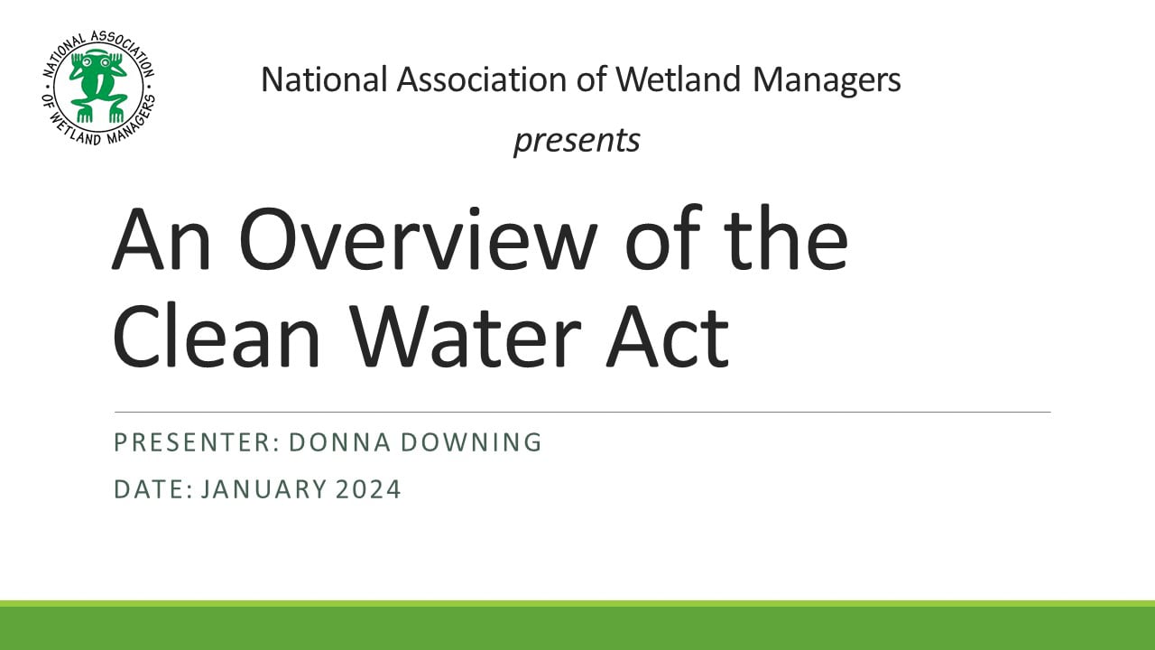
Introduction: Portia Osborne, Project Manager, NAWM;
Trainer: Donna Downing, Senior Legal Policy Advisor, NAWM
EPA has extensive tools, resources and training sessions available online for your use. Resources that are most pertinent to the training workshop are compiled here for your reference:
If you have any questions, please reach out to Portia Osborne, Assistant Director at portia@nawm.org.
Thank you to all the Speakers and Participants for making the
2024 Annual meeting a great success!
Thank You to Our Sponsors
![]()

![]()
![]()
![]()
![]()
Modeling Beavers, Springs, and Seeps
Held Wednesday, October 11, 2023 - 3:00 p.m.-4:30 p.m. ET
INTRODUCTION
- Ian Grosfelt, National Association of Wetland Managers [PRESENTATION PDF]
PRESENTERS
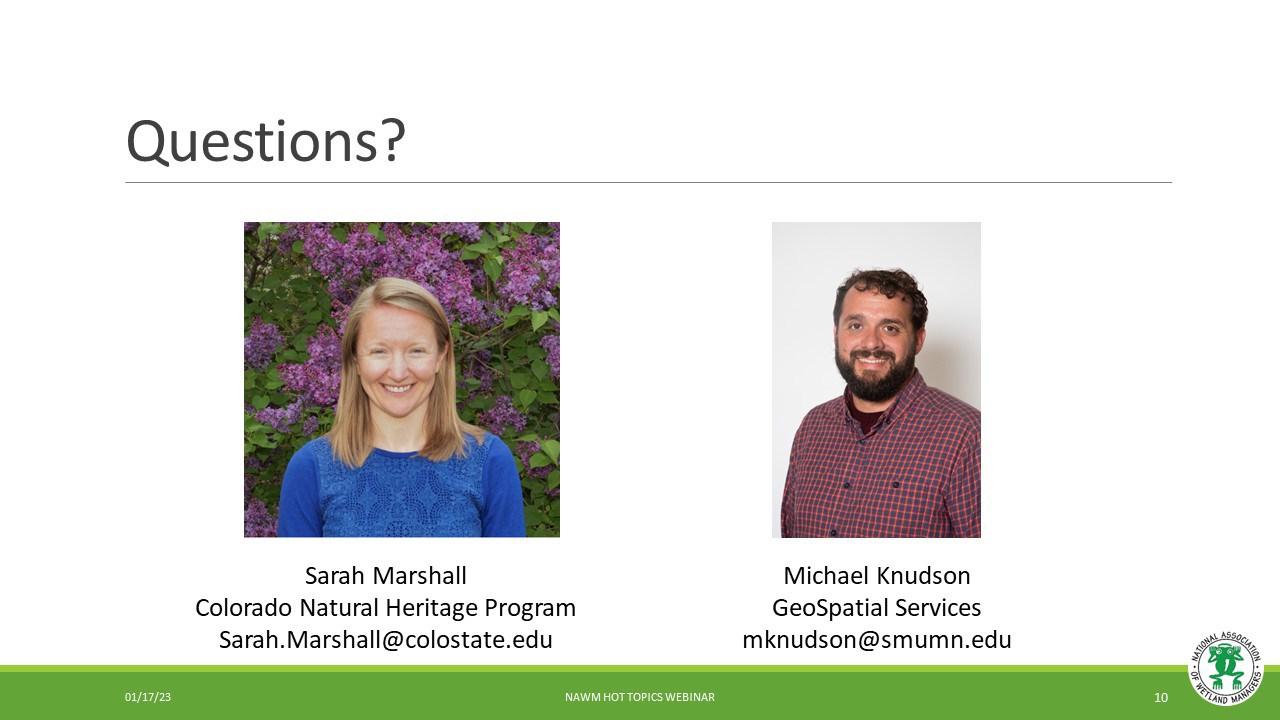
- Sarah Marshall, Colorado Natural Heritage Program [PRESENTATION PDF]
- Mike Knudson, GeoSpatial Services, St. Mary's University of Minnesota [PRESENTATION PDF]
ABSTRACTS
Developing High Resolution, Frequently Updated Wetland and Beaver Activity Maps for Colorado and the West using Machine Learning Techniques, Sarah Marshall, Colorado Natural Heritage Program - Sarah Marshall
As Colorado and the West experience increasing impacts of climate change and human population growth, wetlands and riparian areas are central to any discussion of future water supply. One critical barrier to incorporating wetlands into statewide habitat, water and natural hazard mitigation planning is a lack of recent, frequently updated wetland mapping with coverage across states and river basins. This gap is particularly relevant for the most dynamic wetland types such as headwater floodplain wetlands where wetted areas may change in extent on a scale of 1-10 years. The Colorado Natural Heritage Program (CNHP) and Lynker are collaborating to overcome this barrier by developing remote-sensing based wetland mapping that can be updated to capture past, current, and future wetland conditions. Using a combination of machine learning techniques and iterative expert training and feedback, the project team has worked to model and map wetland boundaries and identify specific wetland features including beaver ponds. Sarah Marshall with CNHP will present on the team’s work across Colorado and the Colorado River basin.
Evaluation of Prevalence Probability Prediction of Ground Water Discharge Springs in Missouri using the MaxEnt Machine Learning Algorithm - Mike Knudson
This project was an exploratory effort to assess the ability of geospatial and machine learning based modeling to predict presence of ground water discharge springs in a pilot study area. Field investigation to locate ground water discharge springs can be time consuming in large geographical areas, especially in areas that are difficult to access. Model development was based primarily on the methods developed by Gerlach et al. (2022). The authors identified six topographic variables as important for locating ground water discharge springs using the MaxEnt model: elevation, planform curvature, profile curvature range, distance to flowlines, terrain ruggedness index (TRI), and flow weighted slope (FWS). For this pilot project, we evaluated performance of these six predictor variables in locating springs in the pilot study area using a MaxEnt machine learning model. We also identified 10 additional variables that were commonly used in geospatial modeling of ground water discharge and evaluated them as potential predictor variables in the analysis.
BIOS
 Sarah Marshall is an ecohydrologist with the Colorado Natural Heritage Program at Colorado State University. Sarah has nearly two decades of experience working with wetland and riparian ecosystems in the western U.S. She has a Ph.D. in Water Resources Engineering, with expertise in ecological restoration and the effects of land use and management on wetland hydrology, soils, and ecology. Her current work focuses on large-scale wetland mapping to help identify high-priority wetland conservation and restoration areas to meet water quality, water supply, and habitat needs in a changing climate. She has also developed a suite of tools and protocols to help understand, manage, and assess the ecological condition of wetlands across Colorado and the West.
 Mike Knudson has been a GIS Analyst at GSS since January 2021. In 2010, Mike earned his B.S. in Natural Resources from the University of Minnesota. In 2014, he obtained an M.S. from the University of North Dakota in Earth System Science and Policy. His research areas integrate remote sensing and environmental monitoring to create data products that inform decision making. He currently serves GSS as a data support specialist assisting with a multitude of wetland mapping and functional assessment projects along with wetland probability modelling. He enjoys traveling and wilderness exploration with his wife and two children, along with wood crafting and upland bird hunting.
Please click only once on each video recording to view in this window.
Part 1: Introduction: Ian Grosfelt, National Association of Wetland Managers
Presenter: Mike Knudson, GeoSpatial Services, St. Mary's University of Minnesota
![]()
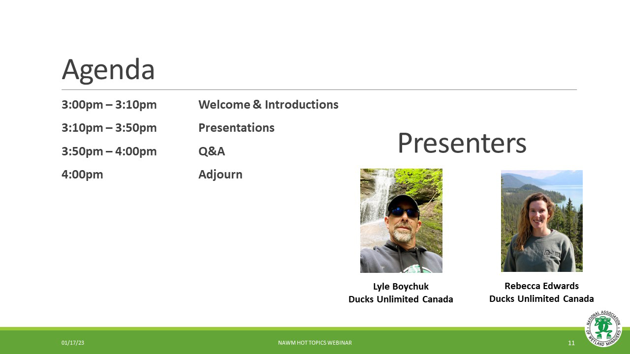
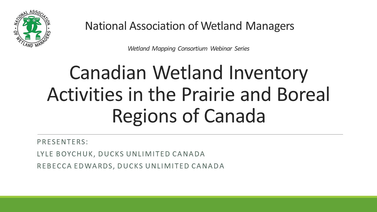
Canadian Wetland Inventory Activities in the Prairie and Boreal Regions of Canada
Held Wednesday, August 30, 2023 - 2:00 p.m.-3:00 p.m. ET
INTRODUCTION
- Ian Grosfelt, National Association of Wetland Managers [PRESENTATION PDF]
PRESENTERS
- Lyle Boychuk, Ducks Unlimited Canada [PRESENTATION PDF]
- Rebecca Edwards, Ducks Unlimited Canada [PRESENTATION PDF]
BIOS
 Lyle Boychuk is the Manager of GIS and Inventory Programs; Prairie Region for Ducks Unlimited Canada. Lyle has been working in geomatics for 27 years and is currently in his 23rd year of service with DUC. He manages a team of specialists responsible for building GIS applications in support of conservation programs and managing the delivery Canadian Wetland Inventory (CWI) projects across Prairie Canada. His professional interests include the use of remote sensing to characterize Prairie Wetlands, the application of terrain data for quantifying wetland hydrology; and the use of UAV technology to support conservation program delivery.
 Rebecca (Becky) Edwards is the lead remote sensing specialist for DUC’s National Boreal Program. She completed her MSc in Geography specializing in remote sensing from Queen’s University focusing on vegetation change in the Arctic. Becky has been working with DUC for over 7 years with experience in wetland remote sensing, time series analysis, northern landscapes, and wetland ecology. She has led and supported many large-scale wetland inventory products across the Boreal to support the Canadian Wetland Inventory (CWI) and continues to advance novel wetland classification methodologies.
Please click only once on each video recording to view in this window.
Part 1: Introduction: Ian Grosfelt, National Association of Wetland Managers
Presenter: Rebecca Edwards, Ducks Unlimited Canada
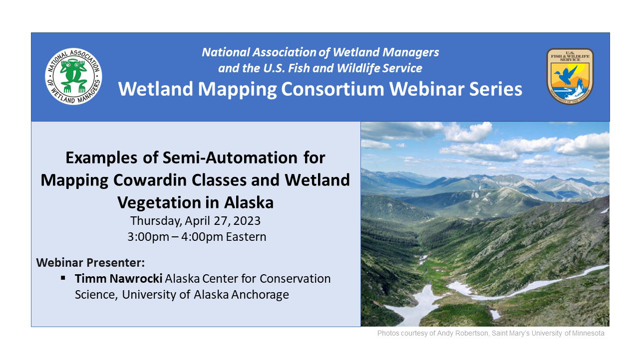
Examples of semi-automation for mapping Cowardin classes and wetland vegetation in Alaska
Held Thursday, April 27, 2023 - 3:00 pm - 4:00 pm Eastern
INTRODUCTION
- Ian Grosfelt, National Association of Wetland Managers [PRESENTATION PDF]
PRESENTER
- Timm Nawrocki, Alaska Center for Conservation Science [PRESENTATION PDF]
ABSTRACT
Wetlands mapped according to the Cowardin Classification have frequently been delineated manually. Despite increasingly available remotely sensed data and access to large amounts of computational resources, automated approaches to mapping wetlands have been limited to ecologically coarse approaches. One challenge to automating the mapping of Cowardin classes is that the Cowardin Classification integrates contextual information that may not be directly represented in remotely sensed data. We have implemented a semi-automated strategy for wetland mapping that retains advantages of automation while enabling a wetland scientist to focus on providing the contextual information necessary to assign Cowardin classes. Additionally, we have implemented automated approaches to mapping wetland vegetation that could be modified by a wetland scientist to arrive at Cowardin classes. Semi-automation has potential to improve consistency, accuracy, and cost-efficiency of mapping Cowardin classes in Alaska and other areas where wetlands occupy large proportions of the landscape.
BIO
 Timm Nawrocki received a B.S. in Biology from the University of Virginia and a M.S. in Biological Sciences from the University of Alaska Anchorage. He specializes in spatial analyses of terrestrial vegetation, soils, and wildlife; remote sensing; and identification of vascular and non-vascular plants. He is fluent in Python, R, SQL, Javascript, geographic information systems (GIS), and web development including a variety of frameworks, platforms, and languages.
Please click only once on each video recording to view in this window.
Part 1: Introduction: Ian Grosfelt, National Association of Wetland Managers
![]()
Presenter: Timm Nawrocki, Alaska Center for Conservation Science, University of Alaska Anchorage![]()
![]()

![]()
![]()
![]()
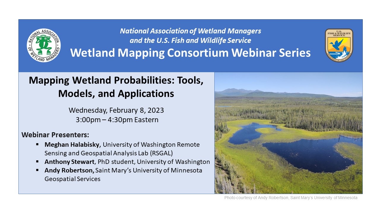
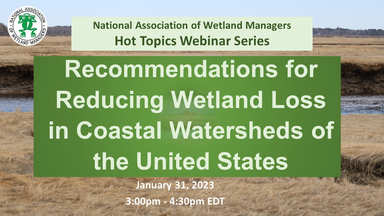
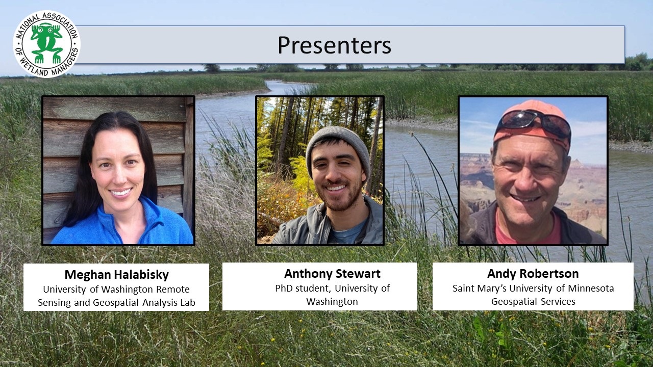
Mapping Wetland Probabilities: Tools, Models, and Applications
Held Wednesday, February 8, 2023 - 3:00 pm - 4:30 pm Eastern
INTRODUCTION
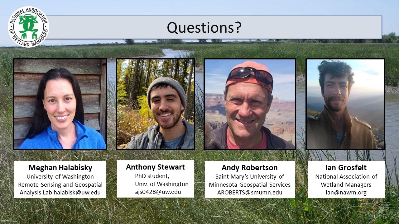
- Ian Grosfelt, National Association of Wetland Managers [PRESENTATION PDF]
PRESENTERS
- Meghan Halabisky, University of Washington Remote Sensing and Geospatial Analysis Lab [PRESENTATION PDF]
- Anthony Stewart, PhD Student, University of Washington [PRESENTATION PDF]
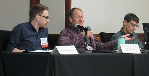
- Andy Robertson, GeoSpatial Services at Saint Mary’s University of Minnesota [PRESENTATION PDF]
ABSTRACTS
Meghan Halabisky
Accurate, un-biased wetland inventories are critical to monitor and protect wetlands from future harm or land conversion. However, most wetland inventories are constructed through manual image interpretation or automated classification of multi-band imagery and are biased towards wetlands that are easy to detect directly in aerial and satellite imagery. Wetlands that are obscured by forest canopy, occur ephemerally, and those without visible standing water are, therefore, often missing from wetland maps. To aid in detection of these cryptic wetlands, we developed the Wetland Intrinsic Potential tool, based on a wetland indicator framework commonly used on the ground to detect wetlands through the presence of hydrophytic vegetation, hydrology, and hydric soils. Our tool uses a random forest model with spatially explicit input variables that represent all three wetland indicators, including novel multi-scale topographic indicators that represent the processes that drive wetland formation, to derive a map of wetland probability.
Anthony Stewart
Inland wetlands disproportionately contribute to the soil organic (SOC) carbon pool by storing 20-30% of all SOC despite occupying only 5-8% of the land surface. However, difficulty identifying wetland areas under perennial forest canopy increases uncertainty in estimates of SOC stocks across watershed to regional scales. We used a machine learning approach that utilized aerial lidar-derived hydrologic and topographic metrics to characterize the landscape surface and identify areas of potential wetland formation for three study areas in the Pacific Northwest which represent an east-to-west (low-to-high) precipitation gradient. This approach produces a spatially explicit and continuous model of wetland probability as a range from wetland to upland across a landscape. We then collected soil samples and measured SOC stocks along the wetland-to-upland probability gradient and used the probability along with surficial geology corresponding to geomorphology to model SOC stocks.
Andy Robertson
GeoSpatial Services has been focused on landscape level wetland inventory and functional assessment for over two decades. Throughout that time we have explored a variety of data development and classification tools for creating derived data that supports comprehensive resource monitoring and assessment. This presentation described several modelling efforts based on machine learning algorithms, object analysis, derived elevation surfaces, network analysis and high-resolution optical imagery. These techniques include: potential wetland landscapes, potentially restorable wetlands, derived and hydro modified surface hydrology and cumulative impact assessment based on proximity to oil field development and potential contamination. These tools will be presented in the context of wetland program plan development supported by EPA CWA Section 404 grants.
BIOS
 Meghan Halabisky is a research scientist at the University of Washington Remote Sensing and Geospatial Analysis Lab (RSGAL). Her interests lie in understanding ecosystem dynamics and landscape change through the development and application of high-resolution remote sensing tools. She completed her PhD at the University of Washington, where she worked to characterize the response of wetland ecosystems to historic and future climate by reconstructing surface water hydrographs for thousands of wetlands in Washington State and using a combination of aerial and satellite imagery. Meghan has a background in conservation management, having previously worked as an operations planner for the Oahu Invasive Species Committee. She has a concurrent master’s – MS/MPA from the Evans School of Public Affairs at the University of Washington.
 Anthony Stewart is a PhD student at the University of Washington. He uses remote sensing to map, characterize, and model wetlands and their soil carbon stocks. Particularly, he is interested in small forested wetlands and their role in the greater landscape.
 Andy Robertson is currently Executive Director of GeoSpatial Services at Saint Mary’s University of Minnesota. In this role, Andy is responsible for oversight and management of all GeoSpatial Services projects, activities and staff. GeoSpatial Services is engaged in a wide variety of projects across the Lower 48 and Alaska including: wetland inventory; National Hydrography Dataset updates; spatial data development; and natural resource condition assessments. GeoSpatial Services has been a key partner of the USFWS and has been working for over 18 years to update legacy National Wetland Inventory data across the nation. Andy is a steering committee member for the NAWM Wetland Mapping Consortium, a NAWM Board Member and is past-chair of the Alaska GeoSpatial Council Wetland Technical Working Group.
Please click only once on each video recording to view in this window.
Part 1: Introduction: Ian Grosfelt, National Association of Wetland Managers
Presenter: Meghan Halabisky, University of Washington Remote Sensing and Geospatial Analysis Lab
![]()
View Past Wetland Mapping Consortium Webinars
PDF List of Past Wetland Mapping Consortium Webinar Recordings
View Upcoming Wetland Mapping Consortium Webinars
The Wetland Mapping Consortium (WMC), founded in 2008, is an interdisciplinary group of wetland scientists and managers interested in mapping and monitoring wetlands with remotely sensed images and/or using the resultant products to best manage wetland resources.
For more information and/or to join our email list for notices about upcoming events, please contact Laura Burchill at laura@nawm.org or (207) 892-3399.
List of Wetland Mapping Consortium Webinar Recordings Here 
Please click on a year below to view past webinars.
| 2011 |
|
|||||||||||||||||||||||||||||||||||
 The Wetland Mapping Consortium (WMC), founded in 2008, is an interdisciplinary group of wetland scientists and managers interested in mapping and monitoring wetlands with remotely sensed images and/or using the resultant products to best manage wetland resources. The WMC Steering Committee organizes webinars on topics of interest to the group.
If you haven’t used Teams before or you just need a refresher, please view our guide prior to the webinar here.
For more information and/or to join our email list for notices about upcoming events, please contact Laura Burchill at laura@nawm.org or (207) 892-3399.
Past Wetland Mapping Consortium Webinars Here
List of Wetland Mapping Consortium Webinar Recordings Here
![]()
Please check back for future Wetland Mapping Consortium Webinars. Thank you.
NWI Updates: What's New at the National Wetlands Inventory Program
Held Tuesday, November 1, 2022 - 3:00 pm - 4:30 pm Eastern
INTRODUCTION
- Portia Osborne, Project Manager, National Association of Wetland Managers [PRESENTATION PDF]
PRESENTERS [PRESENTATION PDF]
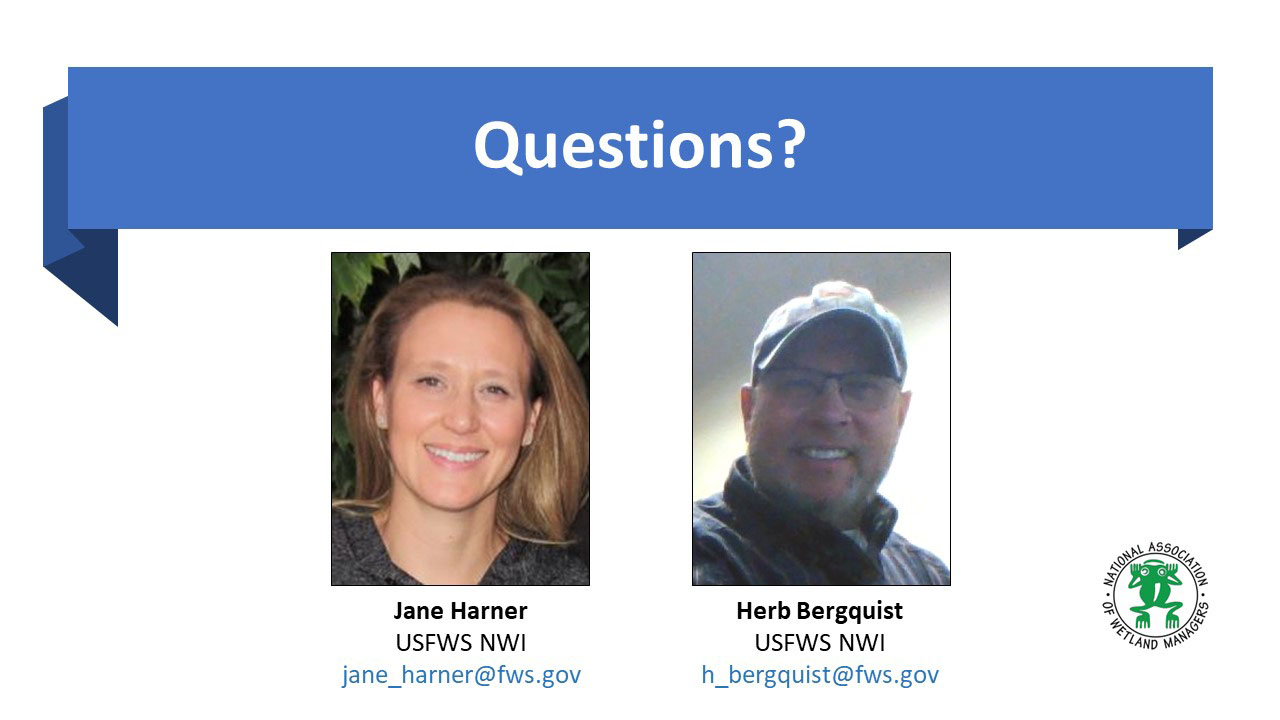
- Jane Harner, U.S. Fish and Wildlife Service National Wetlands Inventory
- Herb Bergquist, U.S. Fish and Wildlife Service National Wetlands Inventory
ABSTRACT
This webinar highlighted what's new at the National Wetlands Inventory Program. This presentation featured important NWI updates for anyone using or producing NWI wetlands data. The presenters provided background on NWI's renewed commitment to working with the USGS NHD/3DEP program in an effort to bring these datasets closer together. In addition, they provided details on new guidance documents, information on mapping wetlands to the Federal standard, introduce a new linear data layer option for those interested in mapping beyond the standard, showcase new and improved QAQC tools, and report on the status of mapping in the U.S. The NWI Program introduced new staff members and provide information on how to best communicate with the Program and request support!
BIOS
 Jane Harner joined the USFWS National Wetlands Inventory Program in 2007 as a GIS Analyst and works at the NWI Data Center located in Madison, Wisconsin. In her current role as Database Administrator, she maintains the National Wetlands Data Layer, incorporating new data updates and preparing data to be posted biannually to the Wetlands Mapper. Jane also assists with project coordination, tracking active mapping projects and facilitating new project initiation. Additionally, Jane is engaged in outreach for the NWI Program, which includes coordinating American Wetlands Month communications and updating website content.
 Herb Bergquist is USFWS National Wetlands Inventory Field Operations Team Lead and oversees NWI Program field operations, supervising regional wetland coordinators throughout the lower 48 states. His position includes project development and mapping management; Quality Control of wetlands data; coordination and communication with partners, cooperators, and contractors; and taking a leadership role in Program visioning development. Herb started working with the USFWS in 1993 as a field technician for the Northeast Loon study and the Environmental Monitoring and Assessment Program (EMAP). After a short stint with the State of New Hampshire Environmental Services program, he returned to USFWS and worked in various capacities for the Northeast Region Ecological Services Division focusing on wetlands, GIS mapping/analysis, and database management. Herb developed and produced numerous wetland functional assessments under Ralph Tiner (NE Regional Wetlands Coordinator) throughout the northeast region during that tenure.
Please click only once on each video recording to view in this window.
Part 1: Introduction: Portia Osborne, Project Manager, NAWM
Presenters: Herb Bergquist, U.S. Fish and Wildlife Service National Wetlands Inventory and Jane Harner, U.S. Fish and Wildlife Service National Wetlands Inventory
![]()
Building on an Initial Wetland Inventory and Classification to Map Ramsar Wetland Sites in Mexico
Held Thursday, September 22, 2022 - 3:00 pm - 4:00 pm Eastern
INTRODUCTION
- Portia Osborne, Project Manager, National Association of Wetland Managers [PRESENTATION PDF]
PRESENTERS
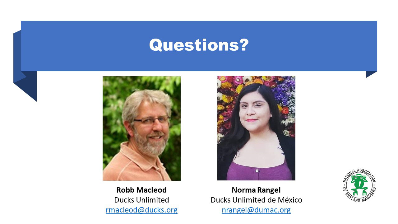
- Robb Macleod, Ducks Unlimited [PRESENTATION PDF]
- Norma Rangel, Ducks Unlimited de México [PRESENTATION PDF]
ABSTRACT
For 30 years, Ducks Unlimited de México (DUMAC) has worked on projects aimed at generating information to classify and quantify the different wetland ecosystems in Mexico. In 1991, DUMAC started the Wetlands Inventory and Classification project in Mexico, which was the first initiative in the country to characterize and quantify the wetlands of Mexico in a homogeneous way with a classification scheme. The objective of this initiative was to generate basic information that would support decision-making to achieve long-term conservation for the benefit of waterfowl and other wildlife. DUMAC, as a leading institution in wetlands mapping in Mexico, is currently working with the National Water Commission (CONAGUA) in the development of a wetlands inventory in northern Mexico (1:50,000) and since 2020 it has been working with the DOI for the mapping of Ramsar Sites in Mexico in coordination with the National Commission of Natural Protected Areas (CONANP).
BIOS

Robb Macleod is the National GIS Coordinator for Ducks Unlimited. He has been working for Ducks Unlimited in the GIS and Remote Sensing field for over 25 years. His current duties include coordinating all of the geospatial activities for Ducks Unlimited. Robb has been active in mapping wetlands in the Great Lakes for over 19 years with previous experience mapping wetlands and land cover in Alaska.
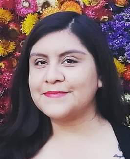 Norma Rangel is a geographer from the University of San Luis Potosí (UASLP) and has a Master’s in Environmental Management from El Colegio de la Frontera Norte (El COLEF). She has worked in academic institutions such as the UASLP and El COLEF, as well as in government institutions such as the National Institute of Statistics and Geography (INEGI). In 2017 she joined Ducks Unlimited de México (DUMAC) as Project Supervisor and since 2020 is the Coordinator of Remote Sensing and GIS Department.
Please click only once on each video recording to view in this window.


Part 1: Introduction: Portia Osborne, Project Manager, NAWM
Presenter: Robb Macleod, Ducks Unlimited and
Norma Rangel, Ducks Unlimited de México
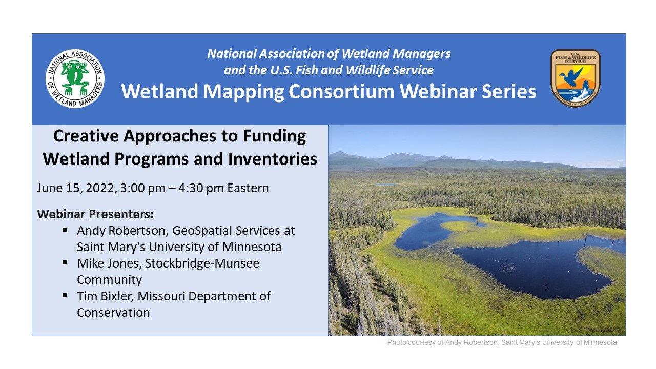
Creative Approaches to Funding Wetland Programs and Inventories
Held Wednesday, June 15, 2022 - 3-4:30 pm Eastern
INTRODUCTION
- Portia Osborne, Project Manager, National Association of Wetland Managers [PRESENTATION PDF]
PRESENTERS
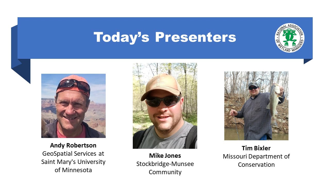
- Andy Robertson, GeoSpatial Services at Saint Mary's University of Minnesota [PRESENTATION PDF]
- Mike Jones, Stockbridge-Munsee Community [PRESENTATION PDF]
- Tim Bixler, Missouri Department of Conservation [PRESENTATION PDF]
ABSTRACTS
Andy Robertson
Creative Approaches to Funding Wetland Programs and Inventories
Creative Approaches to Funding Wetland Programs and Inventories
Saint Mary’s University of Minnesota GeoSpatial Services (GSS) has been working to help build wetland data and programs with a variety of federal and state partners for over 20 years. Recognizing that funding for wetland management can often be challenging to obtain, GSS and our partners have employed a variety of strategies to generate initial and ongoing program funding including:
- Leveraging techniques and technologies – better, faster, cheaper
- Creating linkages to other funded programs (e.g. water quality management)
- Adding value to wetland mapping databases (e.g. hydrogeomorphic attributes, wetland functional assessment)
- Mixing funding sources and levels to share the cost burden
- Development of stakeholder support through education and outreach
This presentation focused on the experiences of two decades of creativity around wetland inventory and program development. Approaches, funding sources, agency involvement and data enhancements were reviewed using specific examples from successful projects.
Mike Jones
The Stockbridge-Munsee Community’s Approach to Funding and Sustaining a Tribal Wetland Program
The Stockbridge-Munsee Community’s Approach to Funding and Sustaining a Tribal Wetland Program
Sustaining a formal wetland program is a major challenge for tribes throughout the country. Tribes often rely on EPA Wetland Program Development Grants (WPDGs), but those have limitations for routine work that is necessary to maintain a program. As a result, many tribes have seen their wetland programs disappear due to lack of long-term funding and staffing. The Stockbridge-Munsee Community (SMC) has been able to sustain their wetland program since 2012 by diversifying funding sources and relying on partnerships within and outside of the Tribe. While WPDGs are still a major funding source, SMC has secured a wide variety of other grant and cost-share funds to cover program activities that are not allowable under WPDGs. SMC also has emphasized building Tribal capacity to improve program efficiency and reduce costs. While each Tribe is unique, some of these approaches can be implemented by other tribes to help sustain their wetland programs.
Tim Bixler
Missouri’s effort to form partnerships and secure funding to update the National Hydrography Dataset and National Wetland Inventory.
Missouri’s effort to form partnerships and secure funding to update the National Hydrography Dataset and National Wetland Inventory.
The current geospatial data for Missouri’s NHD and NWI was largely developed in the 1980’s. Despite their age, inherent inaccuracy, and coarse resolution, both are still foundational GIS layers used on a wide range of applications for a host of federal, state, county, and municipal agencies, as well as by the private sector and individual citizens. Unfortunately, these datasets must be used with broad caveats and limitations. Missouri’s population, landscape, and climate patterns have and are continuing to change, putting lives, properties, infrastructure, and natural resources at risk to natural hazards like extreme flooding. Making informed decisions with difficult trade-offs in a complex world relies on accurate and up-to-date information. Technical advancements in GIS data and processing make updating these two spatial workhorses an attractive venture and would drastically enhance their utility to a host of stakeholders. Communicating across agencies to generate support for such an endeavor takes time, information, and flexibility both within an organization and among partners.
BIOS
Andy Robertson is the Executive Director of GeoSpatial Services at Saint Mary’s University of Minnesota. In this role, he is responsible for oversight and management of all GeoSpatial Services projects, activities and staff. GeoSpatial Services is engaged in a wide variety of projects across the Lower 48 and Alaska including wetland inventory; National Hydrography Dataset updates; spatial data development; and, natural resource condition assessments. Andy has a diverse background in spatial information systems, watershed planning, wetland inventory, forest management, environmental impact assessment, desktop and server system support and database administration. He is a Registered Professional Forest Technologist (Alberta, Canada) and has experience leading natural resource projects for both private sector companies and public agencies across Canada and the United States including the Department of Interior, United States Army Corp of Engineers, NOAA, and the Department of Agriculture. He is also a steering committee member for the Wetland Mapping Consortium and is co-chair of the Alaska GeoSpatial Council Wetland Technical Group. Andy has a Forest Technology Diploma from Sault College of Applied Technology in Ontario, Canada, a B.Sc. in Environmental Science from the University of Waterloo and has completed postgraduate work in forest management at the University of Toronto.
Mike Jones is the Wetland Specialist for the Stockbridge-Munsee Community, a Federally-recognized tribe in Northeast Wisconsin. For the last five years, he has managed the Tribe’s Wetland Program, which focuses on protecting, monitoring, and restoring wetlands on Tribal lands and within the greater watershed. Mike has a B.S. in Biology and Wildlife Ecology from the University of Wisconsin-Stevens Point, and an M.S. in Wildlife and Fisheries Resources from West Virginia University.
 Tim Bixler is the IT Database & GIS Supervisor for the Missouri Department of Conservation (MDC), a state agency that manages the fish, forest, and wildlife of Missouri. In this role he manages the Department’s Geographic Information System (GIS) and SQL Server Environment. Tim represents MDC on the Missouri GIS Advisory Council (MGISAC) and currently serves as the Chair-Elect on the Council. Tim has 18 years of experience working with GIS in natural resource and conservation related agencies and enjoys managing data and applications that help people discover nature and make informed conservation related decisions. He holds a Bachelor of Science degree in Geography with a minor in Cartographic Sciences from Missouri State University and is GISP certified.
Please click only once on each video recording to view in this window.

Part 1: Introduction: Portia Osborne, Project Manager, NAWM
Presenter: Andy Robertson, GeoSpatial Services at Saint Mary's University of Minnesota

![]()
View Past Wetland Mapping Consortium Webinars
PDF List of Past Wetland Mapping Consortium Webinar Recordings
View Upcoming Wetland Mapping Consortium Webinars
![]()
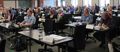
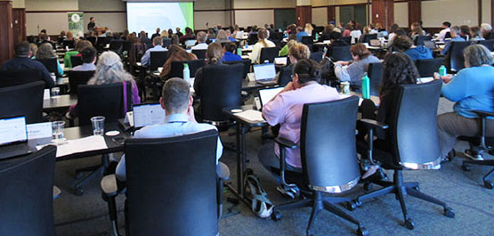
| GROUP PHOTO | ||||||
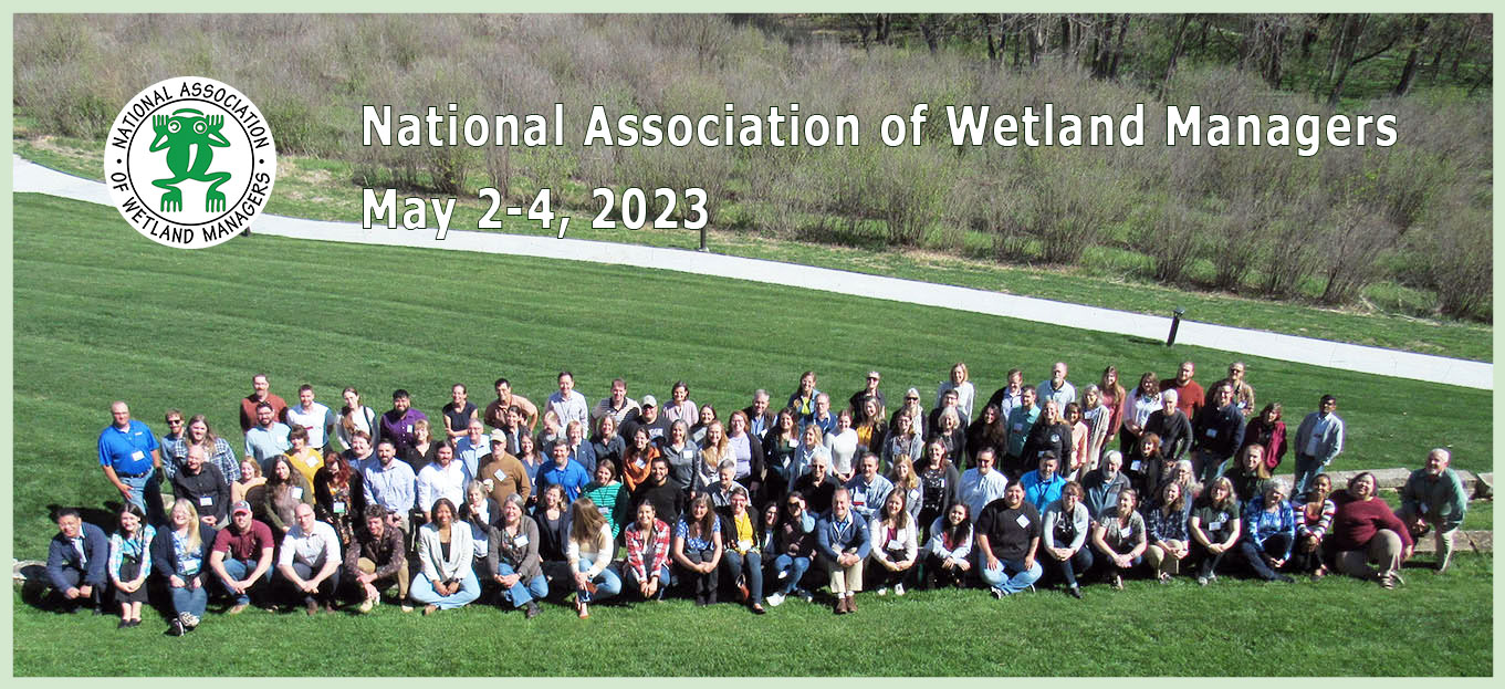 |
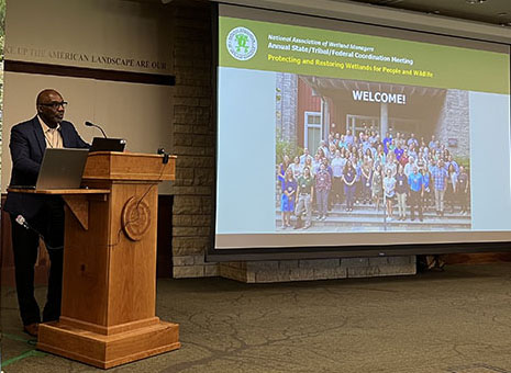
| WELCOME | ||
 |
||
| Marla Stelk, Executive Director, NAWM | ||
 |
 |
|||||
|
Brandley Brandt, Senior Program Manager, |
Tim McCoy, Director, Nebraska Game and Parks Commission |
 |
|||
|
Mark Biddle, Chair, NAWM Board of Directors |
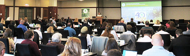
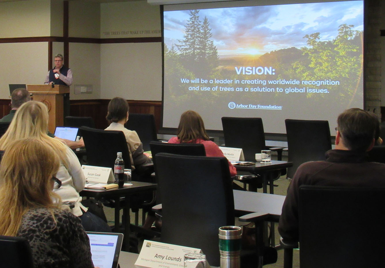
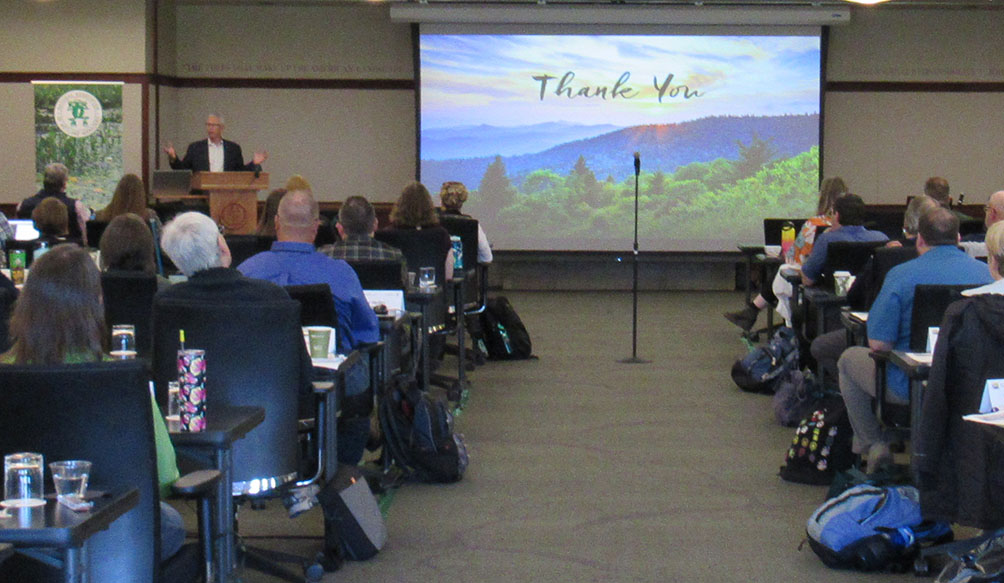
| SESSIONS | |||
 |
|||
|
Brian Frazer, Director, Office of Wetlands, Oceans, and Watersheds, U.S. EPA |
 |
 |
|||||
|
Kathy Hurld, U.S. EPA |
Donna Downing, NAWM |
 |
 |
||||
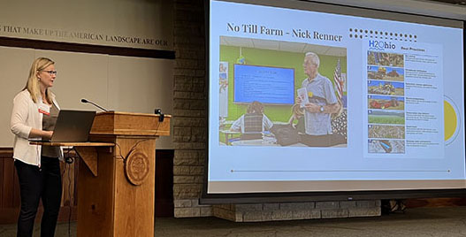
| Dane Pauley, Nebraska Dept. of Environment & Energy | Ian Grosfelt, NAWM | ||||
| |
||
| Marla Stelk, NAWM | ||
 |
||
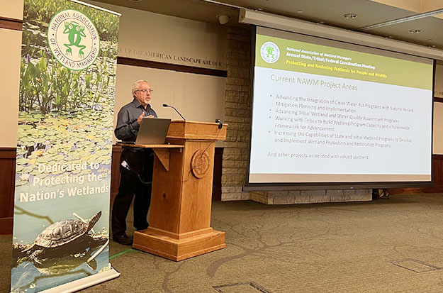
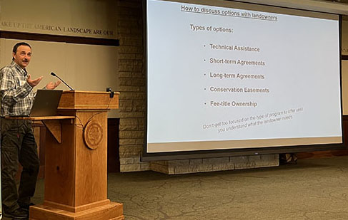
| Panel: Working with Tribes to Build Wetland Program Capacity and a Nationwide Framework for Advancement |
||
|
Moderator: Jeff Lapp, NAWM |
 |
 |
||||||
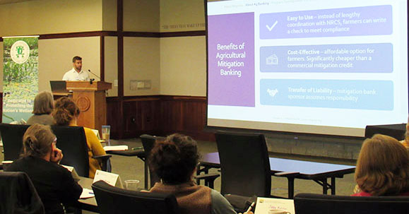
| Ted LaGrange, Nebraska Game and Parks Commission | Ritch Nelson, NRCS | ||||||
 |
 |
|||||
| Mike Glester, Magnolia Land Partners | Becca Madsen, Environmental Policy Innovation Center | |||||
 |
 Attendees Attendees |
|||||
| Karen Menetrey, Rio Grande Return | ||||||
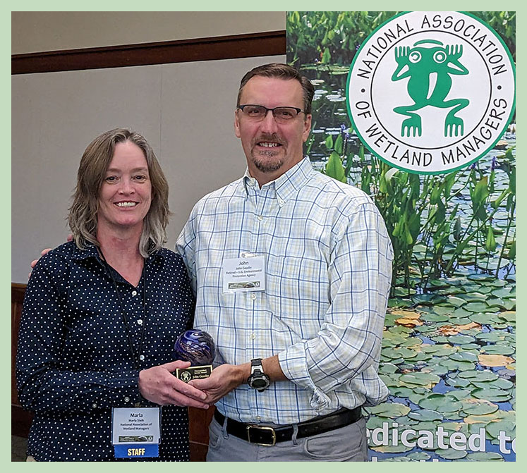
| DISTINGUISHED SERVICE AWARD | ||||||
 |
||||||
| John Goodin Receives the Distinguished Service Award from Marla Stelk, NAWM |
| SESSIONS | ||
 |
||
| Panel: Wetlands and Recreation | ||
|
Tom Malmstrom, City of Lincoln Parks and Recreation Department; |
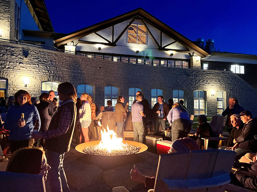
| BONFIRE | ||
 |
| SESSIONS | ||
 |
||
| Wetland Mapping Consortium Panel: Automation and Compliance with FGDC and NWI Standards | ||
|
Moderator, Mark Biddle, Delaware Dept. of Natural Resources & Environmental Control. |
 Attendees Attendees |
 |
|||||
| Blake Walter, Feisburg Holt & Ullevig | ||||||
 Zhenghong Tang, University of Nebraska-Lincoln Zhenghong Tang, University of Nebraska-Lincoln |
 |
|||||
| Jahangeer Jahangeer, University of Nebraska-Lincoln | ||||||
 |
 |
|||||
| Laura Manns, Ohio Wetlands Association | Attendees | |||||
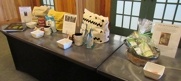
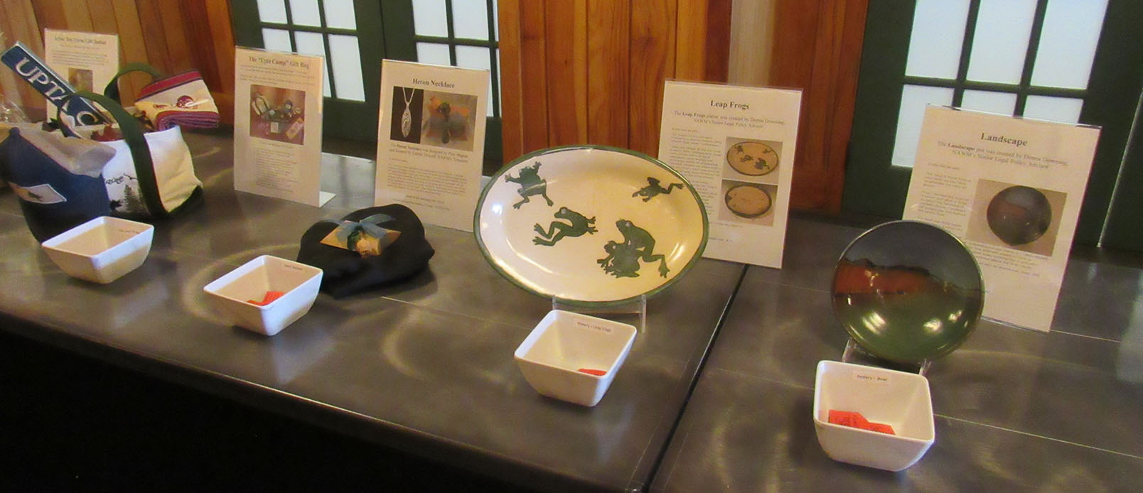
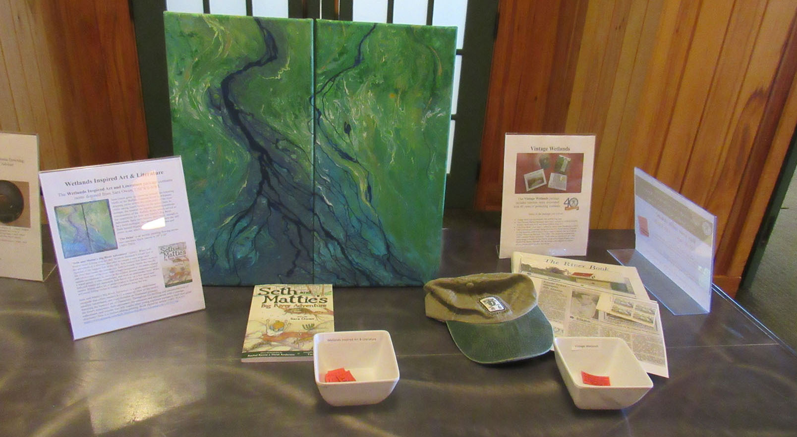
| RAFFLE ITEMS | |||
 |
 |
||
 |
|||
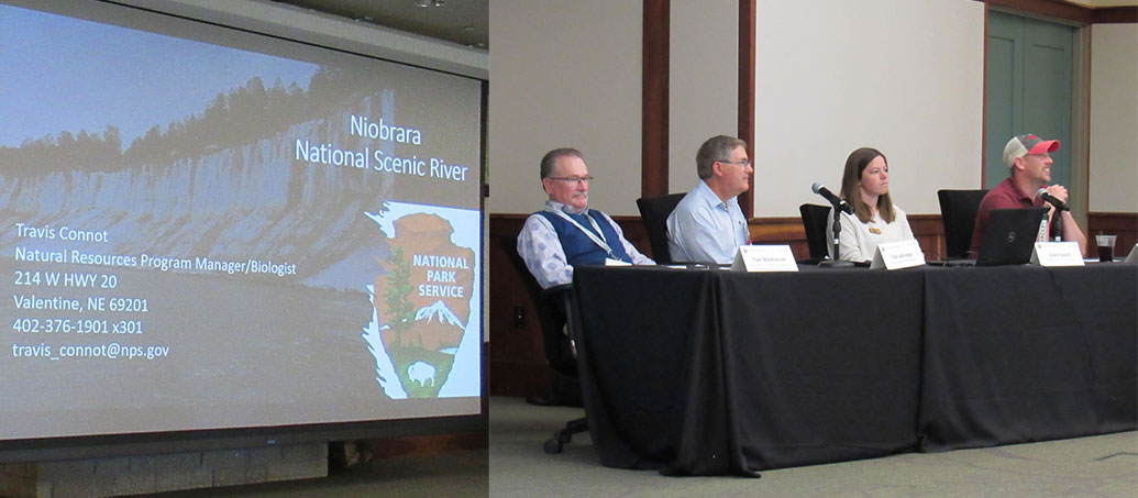
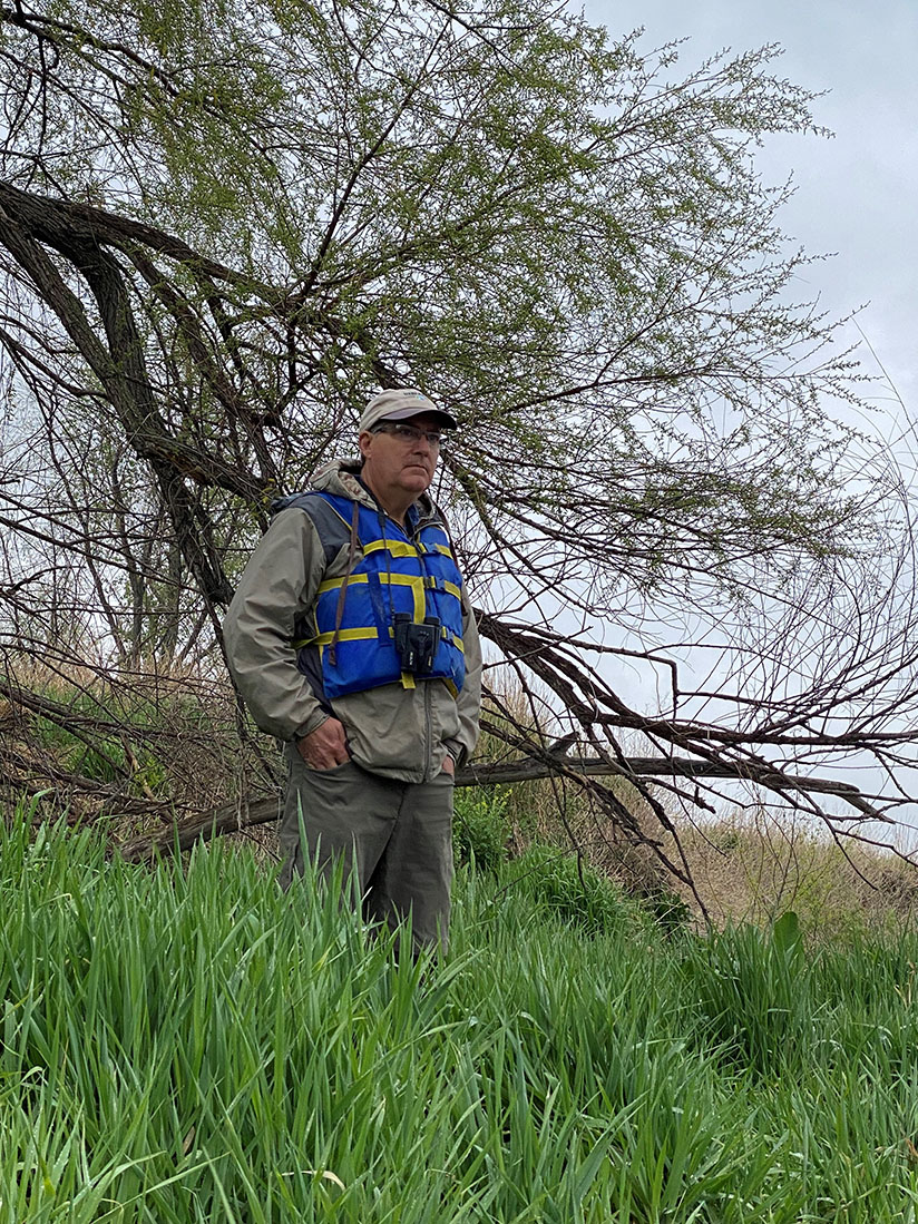
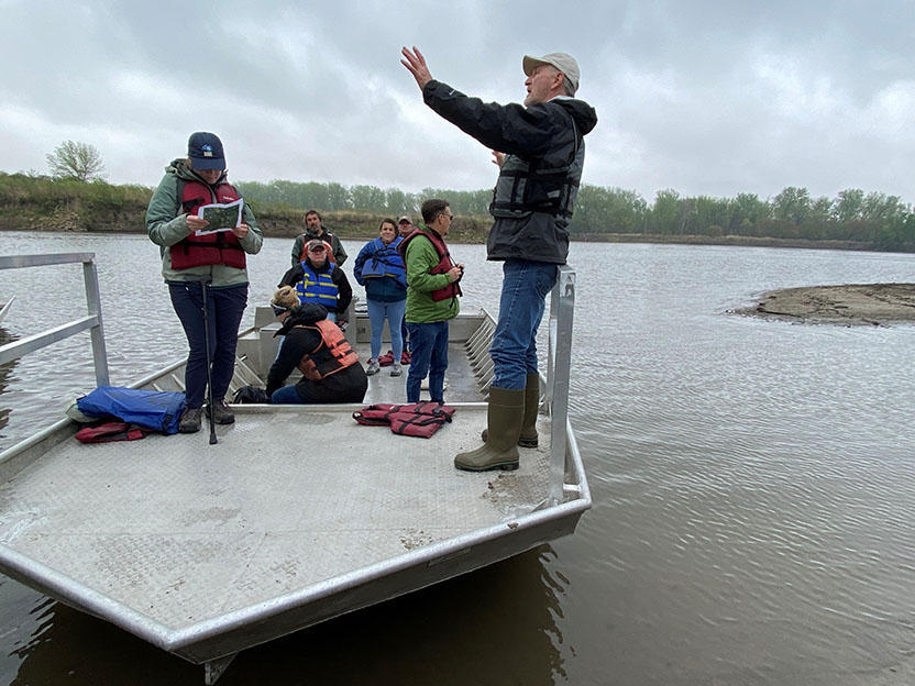
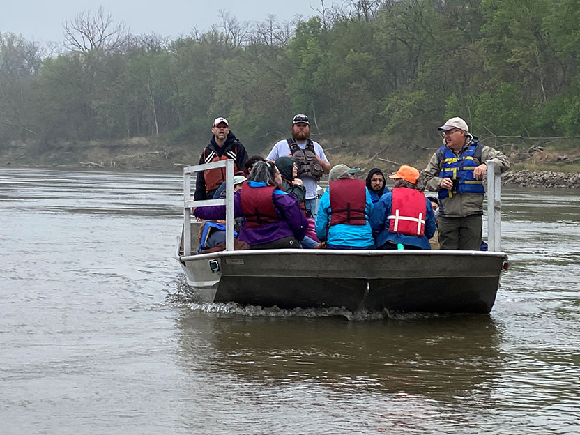
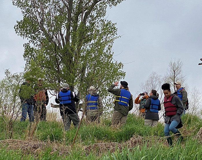
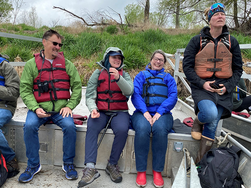
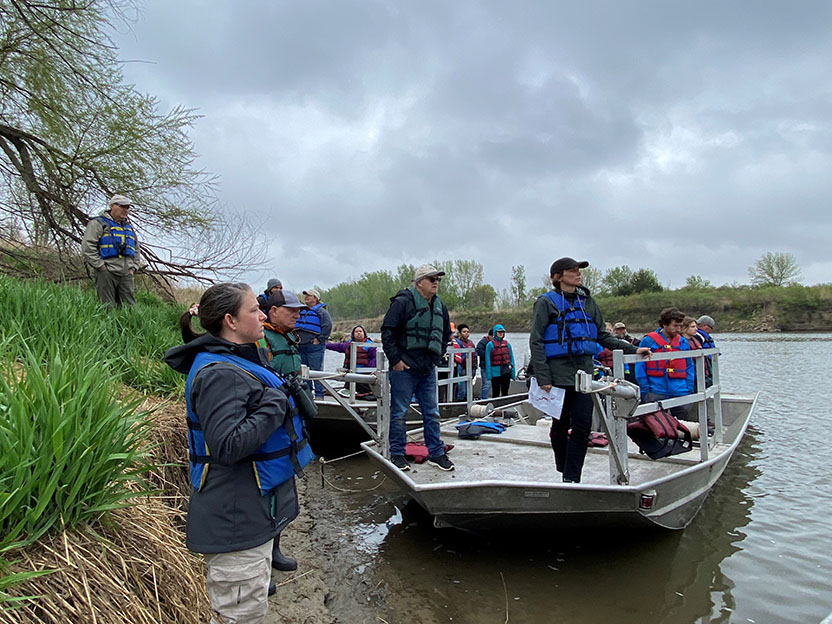
| FIELD TRIP MISSOURI RIVER |
|||
 |
|||
| Field Trip Host: Ted Lagrange, Nebraska Game and Parks Commission |
 |
||
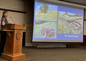
| Hearing about the restoration along the Missouri River | ||
 |
 |
||
| Boat for field triop on the Missouri River | Field trip along the Missouri River | ||
 |
 |
||
| Field trip fun! | Field trip along the Missouri River |
Information on the Annual State/Tribal/Federal Coordination Meeting can be found here.
![]()
MEETING MATERIALS
|
Agenda with Presentations - (Posted 6/13/23) NAWM Resources |
Thank you to our Sponsors Kingfisher Sponsors |
||||||||||||||||||||||||||||||||||||||||||||||||||||||||||||||||||||||||||
 |
 |
||||||||||||||||||||||||||||||||||||||||||||||||||||||||||||||||||||||||||
|
Speaker Materials Notice of Intent to Update the Upland Erosion Control, Revegetation and Maintenance Plan and the Wetland & Waterbody Construction and Mitigation Procedures and Request for Comments. Comment period closes, May 9, 2023. Submitted by Alison Sounders
|
||||||||||||||||||||||||||||||||||||||||||||||||||||||||||||||||||||||||||
|
Strategies and an Action Plan for Protecting and Restoring Wetland and Floodplain Functions (2023) Urban Wetlands Protection and Restoration Guide (2021) Wetland Restoration: Contemporary Issues & Lessons Learned (2017) ASWM Wetland Communications Case Studies Project Report (2017) Government Liability and Climate Change: Selected Issues for Wetland and Floodplain Managers (2016) |
||||||||||||||||||||||||||||||||||||||||||||||||||||||||||||||||||||||||||
|
|
||||||||||||||||||||||||||||||||||||||||||||||||||||||||||||||||||||||||||
Agenda
Marla Stelk, Executive Director
National Association of Wetland Managers
(207) 892-3399; marla@nawm.org
General Information
Laura Burchill, Office Manager
National Association of Wetland Managers
500 Washington Avenue, Suite 201, Portland, ME 04103
(207) 892-3399; Fax: (207) 894-7992; laura@nawm.org
Green Infrastructure Case Studies: How to Successfully Lower Risk in Your Community
Held Tuesday, September 18, 2018 - 3:00 p.m. ET
HOST
Association of State Floodplain Managers
This presentation began with a federal updates by Maria Honeycutt, Ph.D., CFM, Coastal Hazards Specialist at NOAA and Jeanne Christie, Senior Policy Advisor at the Association of State Wetland Managers, followed by a brief Q&A period. This was followed by the updates with our featured webinar presentation entitled “Green Infrastructure Case Studies: How to Successfully Lower Risk in Your Community.” Speakers included: Jennifer Henaghan, AICP, Deputy Research Director and Manager of the Green Communities Center at the American Planning Association; Dr. Tom Ballestero, Associate Professor of Civil and Environmental Engineering at the University of New Hampshire (UNH) and Director of the UNH Stormwater Center; and Jared Soares, Research Analyst at Earth Economics. More information about the presentation can be found below.
PRESENTERS
- Jennifer Henaghan, AICP, , Deputy Research Director and Manager of the Green Communities Center at the American Planning Association
- Dr. Tom Ballestero, Associate Professor of Civil and Environmental Engineering, University of New Hampshire (UNH) and Director of the UNH Stormwater Center
- Jared Soares, Research Analyst, Earth Economics
ABSTRACT
During this webinar, our presenters broke down the anatomy of green infrastructure projects from the design process to cost-benefit analysis to community partnerships. Participants learned about green infrastructure projects for watershed restoration, stream restoration, and integration of stormwater green infrastructure into parks and park systems. The presentation also included a report on the highlights from the September U.S. Army Corps of Engineers Silver Jackets national support team meeting including brief overviews of Federal agency green infrastructure programs.
Please click only once on each video recording to view in this window.
Green Infrastructure Case Studies: How to Successfully Lower Risk in Your Communit
![]()
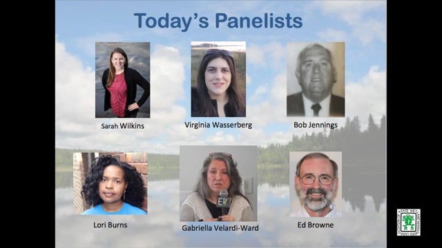
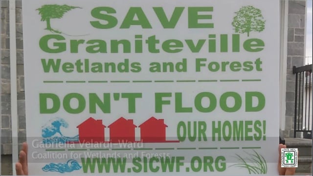
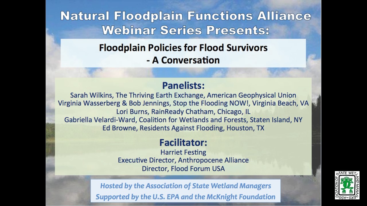
Floodplain Policies for Flood Survivors - A Conversation
Held Tuesday, July 10, 2018 - 3:00 p.m. ET
INTRODUCTION
- Marla Stelk, Policy Analyst, Association of State Wetland Managers [PRESENTATION PDF]
FACILITATOR
- Harriet Festing, Executive Director of Anthropocene Alliance and Director of Flood Forum [PRESENTATION PDF]
PRESENTER
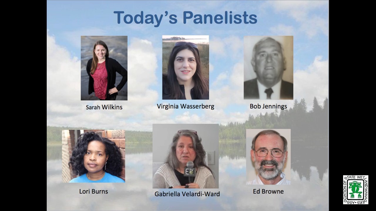
- Sarah Wilkins, Thriving Earth Exchange, American Geophysical Union
- Virginia Wasserberg, Stop the Flooding NOW!, Virginia Beach, VA
- Bob Jennings, Stop the Flooding Now, Virginia Beach, VA
- Lori Burns, RainReady Chatham, Chicago, IL
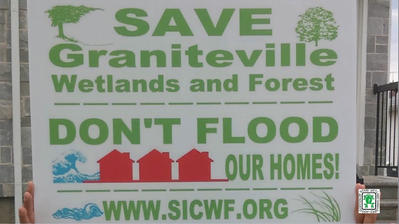
- Gabriella Velardi-Ward, Coalition for Wetlands and Forests, Staten Island, NY
- Ed Browne, Residents Against Flooding, Houston, TX
ABSTRACT
Recent research indicates that by 2050 more than 60 million may be vulnerable to “1-in-100-year” floods. Flood Forum USA is building a national, grassroots movement of communities affected by flooding. We are currently working with 25 flood advocacy group leaders from a dozen states, representing approximately 25,000 residents. Through our partnership with the American Geophysical Union, we have matched many of the groups with expert scientists from academia and federal agencies who are now working alongside them.
This webinar convenes flood group leaders to prompt a discussion on the state and national policies that flood survivors should be advocating for.
Please click only once on each video recording to view in this window.
Part 1: Introduction: Marla Stelk, Policy Analyst, Association of State Wetland Managers
Presenter: Sarah Wilkins, Thriving Earth Exchange, American Geophysical Union
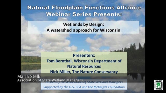
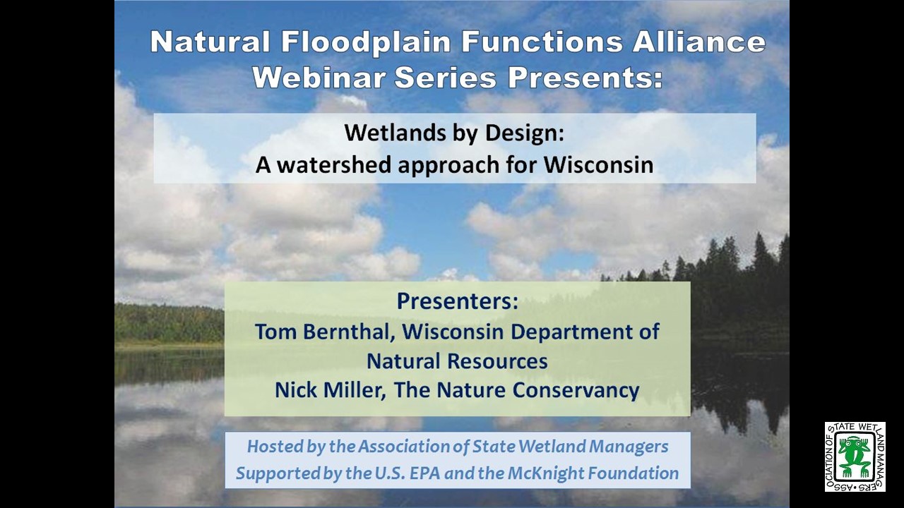
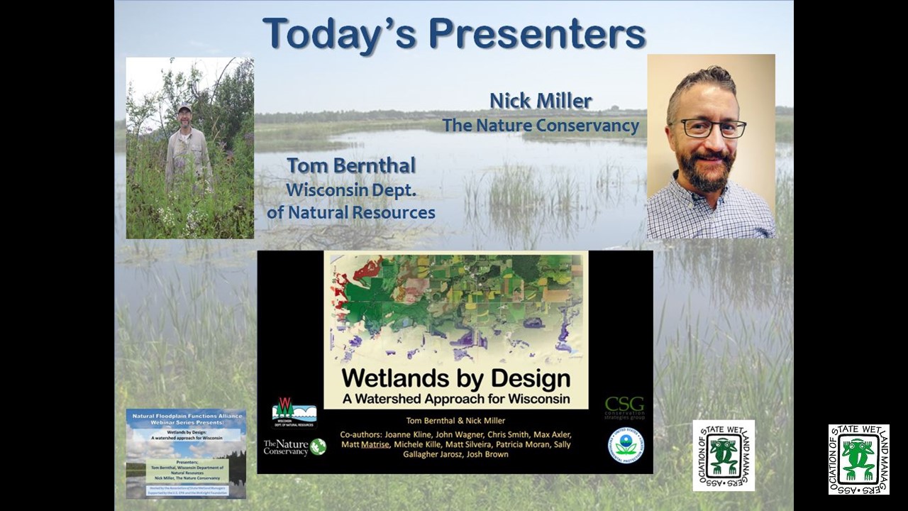
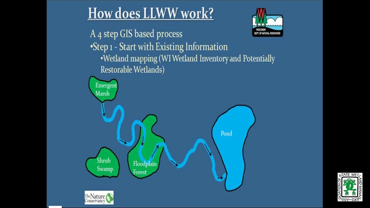
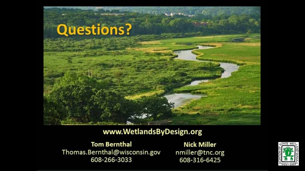
Wetlands by Design: A watershed approach for Wisconsin
Held Tuesday, May 15, 2018 - 3:00 p.m. - 4:30 p.m. EST
INTRODUCTION
- Marla Stelk, Policy Analyst, Association of State Wetland Managers [PRESENTATION PDF]
PRESENTERS
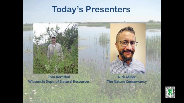
- Tom Bernthal, Wisconsin Department of Natural Resources [PRESENTATION PDF]
- Nick Miller, The Nature Conservancy [PRESENTATION PDF]
ABSTRACT
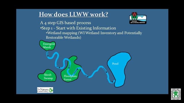
Wisconsin Department of Natural Resources and The Nature Conservancy created a decision support tool that ranks wetland preservation and restoration opportunities for all of Wisconsin’s watersheds based on potential to abate floods, purify water, protect shorelines, maintain streamflow, store carbon, and provide habitat. Wetlands by Design provides a Level 1 GIS analysis, was field validated in the Milwaukee River Basin, and aims to support many users with diverse goals (regulatory/mitigation programs, outdoor enthusiasts, municipalities working to abate floods, etc.). We discussed context and approach, show online mapping tool results, and look forward to a great conversation and feedback.
Please click only once on each video recording to view in this window.
Part 1: Introduction: Marla Stelk, Policy Analyst, Association of State Wetland Managers
Presenter: Nick Miller, The Nature Conservancy
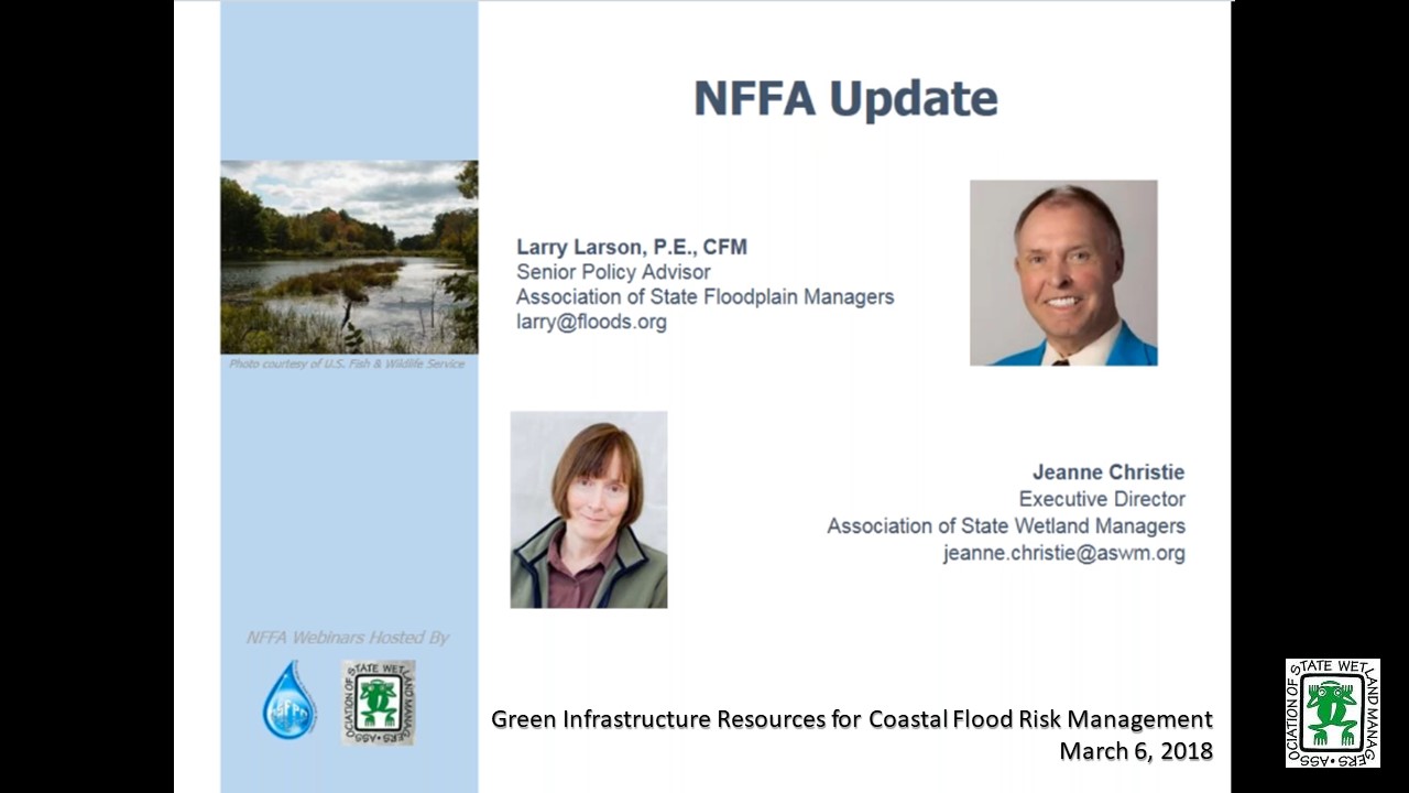
Green Infrastructure Resources for Coastal Flood Risk Management
Held Tuesday, March 6, 2018 - 3:00 p.m. - 4:30 p.m. EST
HOST
Association of State Floodplain Managers
FEDERAL UPDATE
- Larry Larson, Association of State Floodplain Managers
- Jeanne Christie, Association of State Wetland Managers
PRESENTERS [PRESENTATION PDF]
- Maria Honeycutt, Ph.D., NOAA’s Office for Coastal Management
- Lauren Long, The Baldwin Group, NOAA’s Office of Coastal Management
- Tashya Allen, The Baldwin Group, NOAA’s Office of Coastal Management
ABSTRACT
Green infrastructure is gaining popularity as a strategy for protecting communities from coastal hazards, including coastal flooding and erosion. NOAA has developed a suite of products to help coastal managers and planners consider natural approaches to reduce coastal flooding associated with storms and sea level rise and protect coastal ecosystems.
During this webinar, participants learned about resources to help visualize their exposure to coastal flood hazards, explore green infrastructure techniques to reduce impacts, and identify open space to gain credit through FEMA’s Community Rating System. Participants also learned how their peers have tackled coastal flooding challenges using green infrastructure.
Please click only once on each video recording to view in this window.
Green Infrastructure Resources for Coastal Flood Risk Management
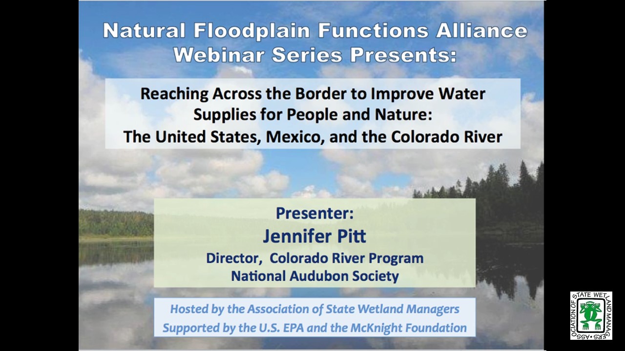
Held Tuesday, January 9, 2018 - 3:00 p.m. Eastern
INTRODUCTION
- Marla Stelk, Policy Analyst, Association of State Wetland Managers [PRESENTATION PDF]
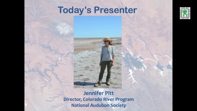
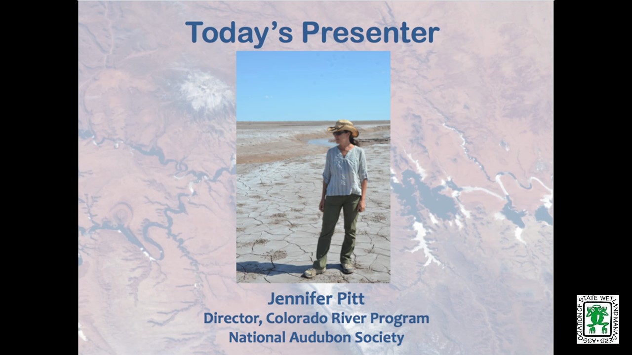
PRESENTER
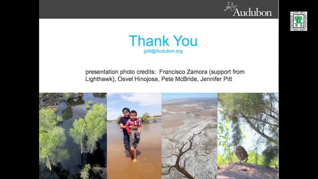
- Jennifer Pitt, Audubon [PRESENTATION PDF]
ABSTRACT
The Colorado River Delta has long been desiccated, due to over-allocation of water supplies and persistent drought. In a series of recent agreements, the United States and Mexico have begun a collaborative effort with non-governmental organizations to restore water to this ecosystem for the purpose of re-creating riparian and estuarine habitat, in the context of agreements that improve the two countries’ ability to manage a diminishing water supply.
Please click only once on each video recording to view in this window.
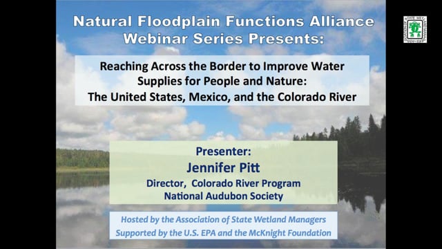
Part 1: Introduction: Marla Stelk, Policy Analyst, Association of State Wetland Managers Presenter: Jennifer Pitt, Audubon
View Past Natural Floodplain Functions Alliance Webinars
PDF List of Past Natural Floodplain Functions Alliance Webinar Recordings
Publications
 The Association conducts research and publishes reports, guidebooks, news articles, brochures, white papers, and summaries of findings of symposia and workshops. These are available electronically to all interested individuals and organizations.